Meadowlark Lake, Wyoming: A Guide to the Southern Bighorns
July 21, 2026 · 7 min read read · Wyo Stays Journal
Meadowlark Lake is a high mountain lake on US-16 — the Cloud Peak Skyway — in the southern Bighorn Mountains of Wyoming, sitting a bit over 8,000 feet between Buffalo and Ten Sleep. It's the southern range's gathering point: trout water, paddling, trailheads, and snow country, all a short walk from the highway.
Most visitors meet the Bighorns from the north — US-14 out of Dayton and Ranchester, Shell Canyon, Burgess Junction. The southern end of the range is quieter, and the drive over Powder River Pass is, in our estimation, the most underrated hour of road in northern Wyoming. We'd know: Wyo Stays is a licensed, insured Wyoming vacation rental brokerage based at 151 W Brundage St in downtown Sheridan, hosting guests since 2017, and the southern loop is what we recommend when a guest says they've already done the famous drives.
This guide covers what the lake actually offers season by season, how long the drive takes from the towns where you're likely staying, and how to build it into a bigger Bighorns day.
What Is There to Do at Meadowlark Lake?
More than its size suggests. In summer, the lake is a fishing and paddling spot first — trout water with easy shoreline access, calm mornings that suit canoes and paddleboards, and picnic areas where the sagebrush gives way to lodgepole. Forest Service campgrounds sit within a few miles, and the trailheads along this stretch of US-16 reach into the Cloud Peak Wilderness, whose namesake summit — at 13,167 feet, the highest point in the Bighorns — anchors the skyline to the north. In fall, the aspen turn and the crowds thin to almost nothing. In winter, this corner of the range becomes snow country: snowmobile trails, snowshoe terrain, and a small historic ski hill beside the lake whose operating status has changed over the years — see our companion piece on skiing at Meadowlark before you plan around it.
| Season | Best activities at the lake | Approx. drive from Buffalo | Approx. drive from Sheridan |
|---|---|---|---|
| Summer (Jun–Sep) | Trout fishing, canoeing and paddleboarding, picnics, camping, wilderness day hikes | ~45–60 min on US-16 | ~1.5–2 hr via Buffalo |
| Fall (Sep–Oct) | Aspen color, quiet fishing, wildlife watching, photography | ~45–60 min, weather permitting | ~1.5–2 hr, weather permitting |
| Winter (Dec–Mar) | Snowmobiling, snowshoeing, cross-country skiing; check current ski-hill status | ~1 hr+; US-16 is plowed but carry chains and check wyoroad.info | ~2 hr+; same caution |
| Spring (Apr–May) | Ice-off fishing, early paddling; snow lingers at lake elevation into May | ~45–60 min | ~1.5–2 hr |
Drive times are honest estimates, not dares — US-16 is a mountain highway that tops out at Powder River Pass, 9,666 feet, and weather does what it wants above 9,000 feet in any month.
How Do You Get to Meadowlark Lake?
From Buffalo, take US-16 west and climb — the road leaves town, gains the foothills, crests Powder River Pass, and drops to the lake on the far side. From Sheridan, run I-90 south to Buffalo first, then follow the same route. Coming from the Bighorn Basin, the approach through Ten Sleep Canyon is the scenic argument-winner: red rock walls, climbers on the limestone, and the little town of Ten Sleep at the bottom, worth a stop on its own.
The smart move is to treat the lake as the hinge of a loop rather than an out-and-back. Go up US-16, spend the middle of the day at the water, come down the other side to Ten Sleep, and decide there whether to circle home through the Basin or retrace the pass at golden hour. Our full Bighorn Mountains loop drive guide lays out the long version that ties the southern and northern crossings together. If you'd rather add a rough gravel detour on the same side of the range, the Crazy Woman Canyon drive is the one to read first.
The north end of the range gets the postcards. Give me the south end in late September — the lake flat as glass, the aspen going gold, and one other truck in the lot. — a Wyo Stays local
Lodges, Camping & Services Around the Lake
Services up here are thin by design — that's the point of the southern Bighorns. A lodge has operated beside the lake for decades, historically renting cabins and, in season, running the little ski hill; it changed ownership in 2026, so check its current offerings directly before counting on meals, rentals, or fuel. Forest Service campgrounds in the area take reservations for some sites and hold others first-come; check fs.usda.gov for the Bighorn National Forest before a summer weekend, because the lake basin fills up while the rest of the range stays empty. Cell service at the lake ranges from weak to none, so download maps in Buffalo or Ten Sleep.
Pack accordingly: layers even in July, water, a real spare tire, and bear-aware food storage — this is black bear country, and coolers left on picnic tables train bears the wrong lessons. Fuel up in Buffalo or Ten Sleep; there's no gas at elevation.
Stay Nearby: Cabins Toward the Southern Bighorns
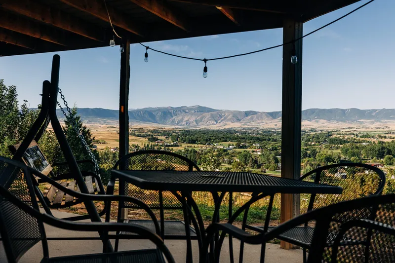
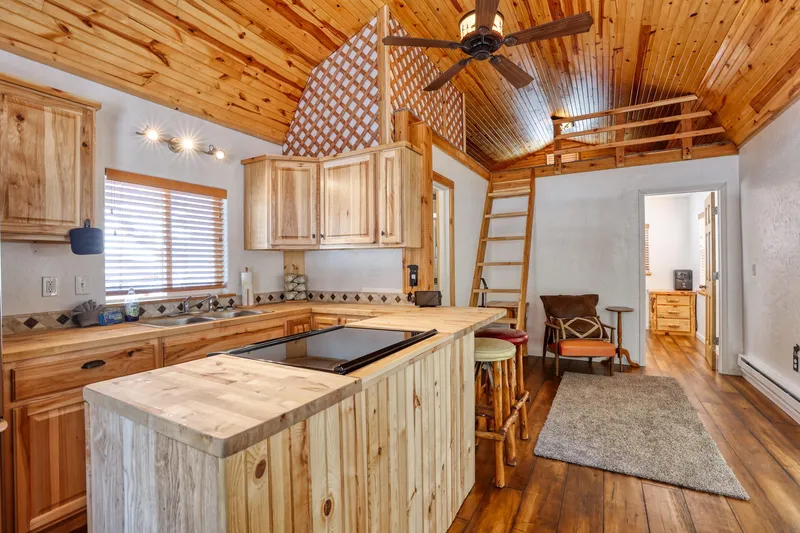
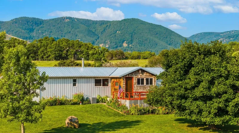
The right base for a trip to this side of the range is a cabin on the Buffalo–Story side of the range — close enough that the US-16 climb starts ten minutes from your coffee pot, far enough down the mountain that you sleep at a friendlier elevation. Our cabin collection toward the southern Bighorns runs to full kitchens for pre-dawn fishing breakfasts, decks that face the peaks, and parking that fits a truck with a canoe on top. Several homes welcome dogs. Browse current availability at book.wyostays.com — Book Direct — No Channel Fees.
Practical Tips
- Check book.wyostays.com for cabin availability before summer weekends — the south side books thinner than Sheridan but earlier than you'd think in July.
- A Wyoming fishing license is required for the lake — buy online from Wyoming Game & Fish before you lose cell signal.
- Check wyoroad.info for US-16 conditions October through May; the pass closes temporarily in storms.
- Mornings are calmest for paddling — afternoon wind is a near-daily habit on high lakes.
- Fuel and groceries: Buffalo on the east side, Ten Sleep on the west. Nothing dependable in between.
FAQ: The Lake & the Southern Bighorns
Q: What is Meadowlark Lake in Wyoming?
A: It's a high mountain lake on US-16, the Cloud Peak Skyway, in the southern Bighorn Mountains between Buffalo and Ten Sleep. Sitting a bit over 8,000 feet, it serves as the recreation hub of the southern range — fishing, paddling, camping, and nearby trailheads in summer; snowmobiling and snowshoeing in winter.
Q: How far is the lake from Sheridan or Buffalo?
A: From Buffalo, plan roughly 45 minutes to an hour west on US-16 over Powder River Pass. From Sheridan, take I-90 south to Buffalo first — about 1.5 to 2 hours total. Both estimates assume dry roads; in winter, add time and check wyoroad.info before committing to the pass.
Q: Can you fish and paddle there?
A: Yes — it's trout water with easy shoreline access, and calm mornings suit canoes and paddleboards well. You'll need a valid Wyoming fishing license, best bought online before you leave town since cell service at the lake is unreliable. Afternoon wind is common on high lakes, so paddlers should plan for morning sessions.
Q: Is the area open in winter?
A: US-16 is a plowed, year-round highway, though it closes temporarily during storms. The lake basin becomes snowmobile and snowshoe country from roughly December through March. The small ski hill beside the lake has operated on and off under different owners over the years — verify its current status directly before planning a downhill day around it.
The southern Bighorns don't advertise. That's exactly why the people who know them keep going back — and why a cabin within reach of US-16 turns one good day at the water into three. Plan your trip, then find your base camp at wyostays.com.